Only one way to go, and fortunately it’s south
While walking across Manhattan along 42nd Street offers many interesting sights to see, it’s not exactly a walking challenge. For that I decided to walk the length of Manhattan along 5th Avenue. and Broadway (the dividing lines between east and west).
I decided to begin my walk in Harlem and walk south to Battery Park. The reasoning was two-fold: one, I wasn’t sure what Harlem would be like and I’ve found that it’s far better to go through dodgy neighbourhoods early in the day than in the afternoon or evening. Second – as I’ve stated elsewhere on this blog – going south feels like you’re going downhill.
When I got off the number 3 subway at 135th Street, I concluded I’d probably made the right choice in starting rather than finishing here. According to this handy tool from the New Yorker, household wealth drops off quite quickly the further north you go from here. Now this isn’t to say that less affluent areas are guaranteed to be high crime, but I figure it’s better to somewhat safe than sorry.
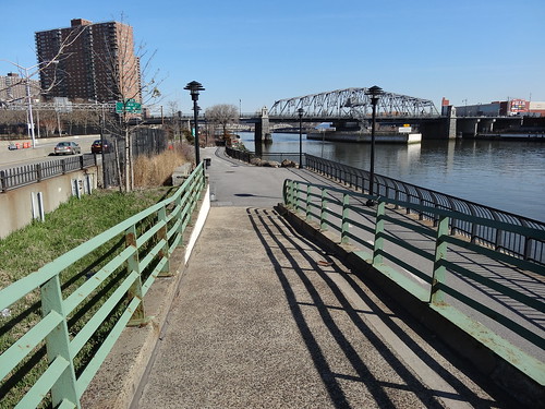
The Harlem River, official starting point for the walk
From here I made my way north to the Harlem River so I could begin the walk south. I was very conscious that a stocky, white guy in shorts (it was only about 10C out) taking photos of things like street signs, probably stood out just a little bit. However, I was not alone, as another obvious tourist with a much more conspicuous camera than mine had also decided to come to the northern limit of 5th Avenue.
Given that I had over 10 miles to walk, I didn’t bother to stick around and chat. The first 20 blocks weren’t really that interesting, just social housing and other medium to low-rise apartment buildings with occasional glimpses of the Empire State Building offering just enough inspiration to keep going.
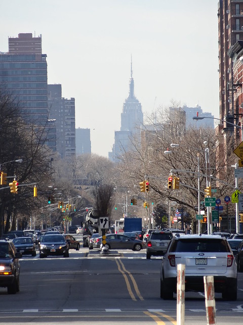
The Empire State Building in the distance
Marcus Garvey Park was somewhat of a surprising obstacle, since I’d not spent a great deal of time looking at a map before setting off. The quickest and most obvious route would have been to just walk straight through the park, but seeing a group of a about a dozen guys drinking beer from paper bags at 10am made me second-guess this decision and instead I just walked around it.
I passed more social housing projects, which I find somewhat surprising given how close I was to Central Park. My original image of New York was that anyone living within a few blocks of Central Park was likely to be at worst upper middle class. So it’s interesting to see that this isn’t always the case.

Sign for one of the many social housing projects I see along the first section of my walk.
Central Park transforms the nature of the walk as I no longer had any buildings immediately to the west of me and wouldn’t again for the next 50 blocks! This was the most open the walk would feel until the end.
I was somewhat tempted to walk through the Park instead of along the increasingly busy and traffic-clogged 5th Avenue, but I have found in the past that parks don’t really offer very interesting insights into a city. Plus, my wife and I had already visited it the day before.
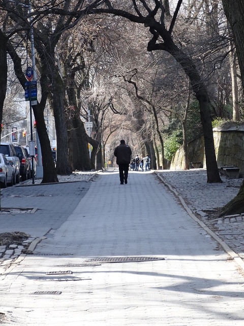
Walking along the edge of Central Park
This turned out to be a good decision as I was able to at least see the outside of many museums along Museum Mile. The area also became noticeably wealthier. Gone are the social housing projects, replaced with buildings with one (or often more) doormen.
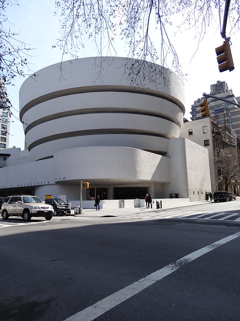
The Guggenheim is arguably the most interesting of the buildings along Museum Mile
While I didn’t really have time to visit any of the museums during my walk I figure I can at least pop in and use one their facilities. I decided that MoMa would make as good a choice as any other. However, I can’t even get into the building without a security screening and then I am told that all restrooms are after the ticket barrier (an adult ticket costs $25).
This is a marked contrast to the museums in London where you never have to pass through security checkpoints and often don’t have to pay for entry. Given there was nothing I could really do, I continued my walk south past the Central Park Zoo and to the southern end of Central Park.
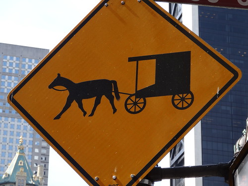
I know this sign is supposed to be for handsom cabs, but looks more like an Amish buggy
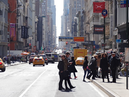
I had now walked over 80 blocks, which sounds a bit more impressive than the actual distance of 4.5 miles. Once again the scenery changed completely going from being at least partially open to a concrete and steel valley of skyscrapers rising up either side of me. I was now on the world famous 5th Avenue – miles, both literally and figuratively, from the 5th Avenue in Harlem.
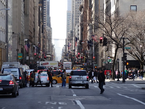
The world famous section of 5th Avenue
Not being one for shopping or crowds, I knew this section of 5th Avenue was likely to be my least favourite and it did not disappoint. I was constantly dodging groups of shoppers as I attempted to continue heading south. Of course, I can’t really complain too much as I was constantly stopping to take photos of things along the way.
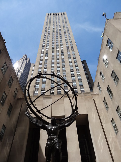
As a 30 Rock fan this guy looked familiar…
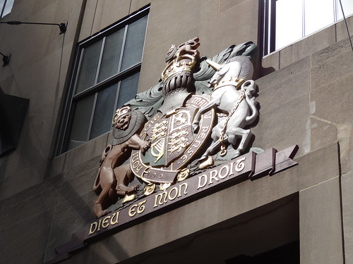
Also the Royal coat of arms of the United Kingdom on the oddly named British Empire Building
There is a certain relief of being a tourist surrounded by other tourists. While I’m sure I got in someone’s way at some point along this section of the walk, at least I don’t stand out and can take my photos in relative anonymity. I reached 42nd Street which was the intersection with my much shorter east-west walk and meant that I’d now walked 100 blocks!
The Empire State Building which had looked so far away back in Harlem was now just a few blocks south. However, as I approached it, I found it nearly impossible to get a good photo. It’s simply too tall relative the surrounding streets.
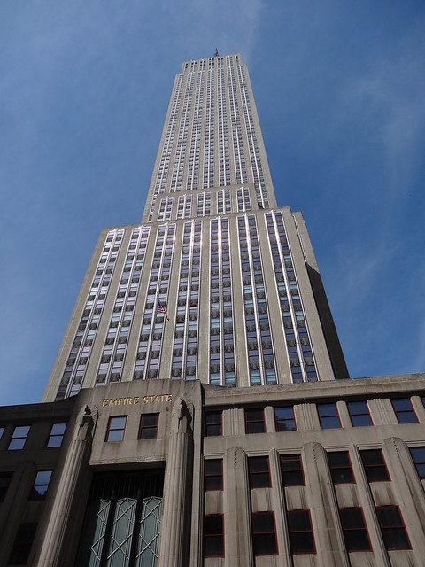
In case you can’t tell, this is the best photo I could get of the Empire State Building
I’d also agreed with my wife to meet here and we could continue the rest of the walk together. As I’d arrived a bit earlier than I’d predicted I decided to see if I could get any better pictures of the building by going down some side streets and getting a little further off 5th Avenue. While, I failed at getting a decent photo I did stumble upon some more colourful businesses than I was expecting in the area.
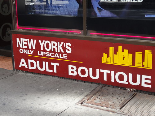
This place looked anything but upscale.
I finally gave up trying to get a better picture of the Empire State Building, and met up with my wife. We grabbed a quick bite to eat and then we’re on our way together. Time certainly seems to pass much faster when we’re walking together and before I know it we’re at the Flatiron Building
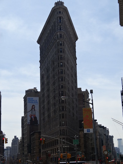
Pretty. Toronto has one of these too!
While the plan is to eventually finish the walk along Broadway, we didn’t follow it at this point and instead continued down 5th Avenue to Washington Square Park, admiring the relatively low-key but undeniable wealth of Greenwich Village.
Looking back up 5th Avenue at Washington Square Park
At the end of 5th Avenue, after 140 blocks and 7.5 miles of walking it felt as though I should be nearly done. I mean, I’d walked all the way south from 142nd Street to the point where 5th Avenue ends and the streets are no longer numbered but actually have names. Reality proved slightly different as there was still another 3 miles of walking to come.
Looking south down Broadway
We shift the walk a few blocks east and continue down Broadway. It reminds us both of Yonge Street in Toronto, full of chain stores and restaurants – the sort of place you go when you don’t know where else to go.
Those words don’t sound like they should go together…
The monotony was eventually broken by the impressive Manhattan Municipal Building and the less impressive City Hall. Yet, they were just an added bonus as I had not gone out of my way to see them. Instead, I’d picked this route because I knew it would bring me past the 9/11 Memorial and the base of the ridiculously nicknamed Freedom Tower.
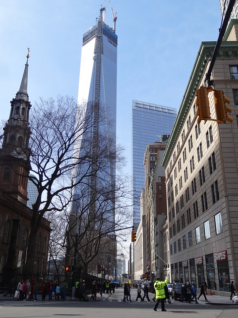
Silly name, but very impressive building
Unlike virtually any other memorial site in the world, you can’t just turn up and go in to the 9/11 memorial. Instead you can either book online or turn up and hope you can get passes to get in. On top of that there are a huge number of rules and regulations you must follow. Given that the goal was to walk Manhattan not spend all day in a queue, we only had a very quick look before continuing on.
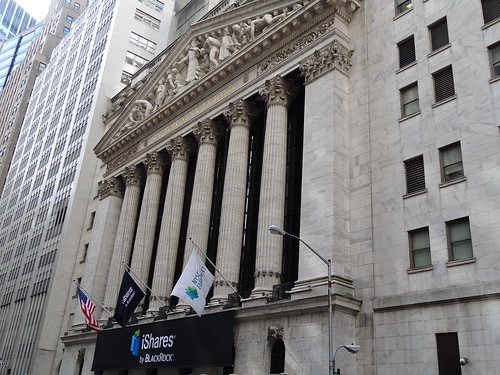
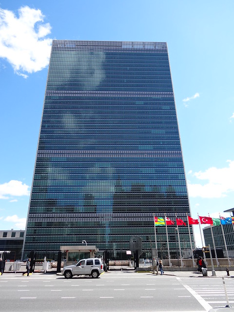
New York Stock Exchange (NYSE), centre of global capitalism?
Our last stop before finishing was to have a quick look at Wall Street. While this may be the global centre of capitalism – unless you work in The City – it was all a bit underwhelming. The NYSE building is indeed impressive but less so than many others I’d seen that day. Perhaps I was just ready to be done.
A quick walk down the surprisingly empty and quiet Broad Street and over to Battery Park and it was. At 10.5 miles (4.5 of which accompanied by my lovely wife), it was shorter than any of my Tube walks except the Waterloo & City line. Yet, I feel like I’ve seen far more than I do on a typical Tube walk.
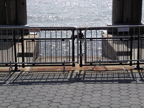
New York Harbor, the symbolic end to my walk.
I think this is likely due to the fact that this is the first time I’ve visited New York as an adult. Thus, the impact of seeing many of the sights of New York was much greater than in London, where I’ve seen the sights dozens of times prior to passing them on a Tube walk.
Beyond that it’s difficult to compare the two cities too much as they are so different. London is a much older, lower rise, sprawling city, whereas Manhattan is much newer, denser and more self-contained (being an island helps of course).
Besides that, there are only two other observations that come to mind. First, New York’s neighbourhoods feel more homogeneous than those in London. For example, Harlem felt pretty universally poor and Greenwich Village felt universally rich. Conversely, in London, you’ll often get council estates next to some of the most expensive real estate in the world.
Second, New York feels like it has fewer hidden secrets than London does; everything just feels a little bit more out in the open. In London, I’m frequently surprised by what I find on my walks, whereas in New York both walks yielded fewer genuine surprises than I would have expected. Both walks were the perfect way to see Manhattan, but it helped reinforce that London is my home.
What do you think about how I’ve portrayed Manhattan? Fair? Way off base? Let me know in the comments section below: