Earlier this month I became the first person to walk the entire new (2015) tube map, in support of Bowel Cancer UK.
During 39 walks between August 2012 and August 2015, I took thousands of photos and noticed that I tended to focus on things that had changed, were likely to change or oddly have not yet changed.
This could include anything from buildings under construction to abandoned (ghost) stations to anachronisms to important international events. London is a unique place where you can to see change unfold right before your eyes.
Below I’ve featured 39 photos, one photo from each walk, that mostly look at some aspect of change in London that I observed during the past 3 years.
These are not necessarily my best photos or even good photos, but each of them tells a small London story that I find interesting. I hope you do too.
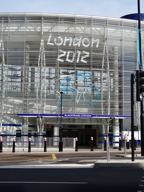
Date Taken: August 19, 2012
Walk 1: Waterloo & City line, Waterloo to Bank
About the photo: Blackfriars Station. This photo of was taken between the end of the 2012 Summer Olympics (25 July to 12 August 2012) and the start of the 2012 Summer Paralympics (29 August to 9 September 2012). Just a small reminder of how of London was blanketed with signs for London 2012 just a few years ago.
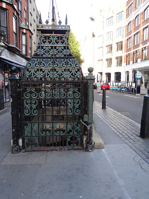
Date Taken: September 29, 2012
Walk 2: Victoria line, Walthamstow Central to Brixton
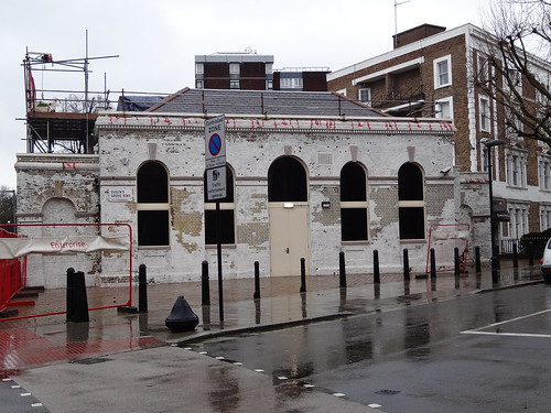
About the photo: Old public toilet, Fitzrovia. I thought this rather ornate, disused Victorian public toilet seemed slightly out of place in modern London. By sheer coincidence the rather quirky Attendant coffee shop opened here just 4 months after this photo was taken.
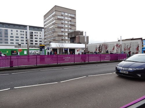
Date Taken: October 20, 2012
Walk 3: Bakerloo line walk 1 – Harrow & Wealdstone to Kilburn Park
About the photo: Wembley Central. This shows the what the area looked like before most of the current development work started. It also shows that a fair bit of London 2012 signage remained for months after the end the 2012 Summer Paralympics.
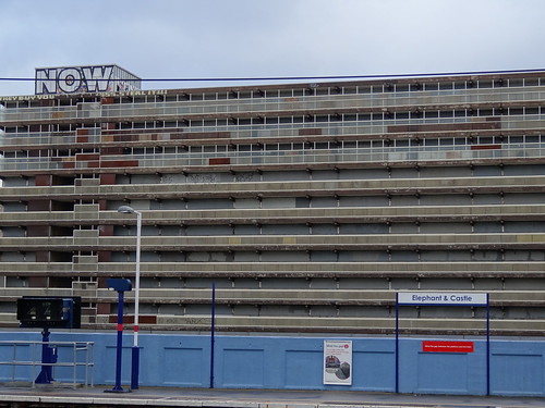
Date Taken: October 27, 2012
Walk 4: Bakerloo line walk 2 – Kilburn Park to Elephant & Castle
About the photo: The photo shows the former Heygate Estate as it was awaiting demolition.
Date Taken: November 17, 2012
Walk 5: Hammersmith & City line – Barking to Hammersmith
About the photo: This shows the Walkie Talkie (aka 20 Fenchurch Street) under construction and also includes Paleys upon Pilers, which has now been moved from this location.
Date Taken: December 29, 2012
Walk 6: Circle line – Hammersmith to Edgware Road
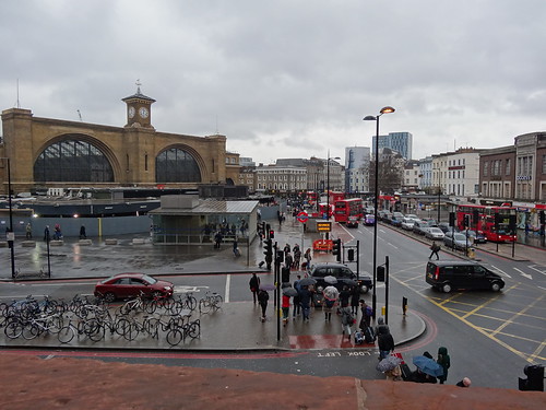
About the photo: This photo shows what King’s Cross looked liked before the old green canopy was fully removed. King’s Cross station was something of one of focal points of my tube walks, since 6 lines converge at King’s Cross-St. Pancras Underground station. It was interesting to watch the station’s exterior change over the course of 2012-13.
Date Taken: February 2, 2013
Walk 7: Jubilee line walk 1 – Stratford to Waterloo
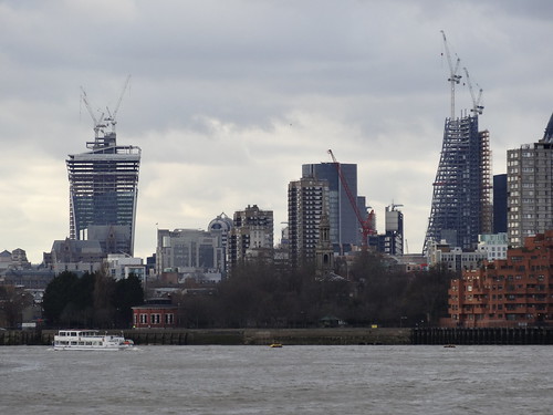
About the photo: Shows both the Walkie-Talkie and Cheesegrater under construction.
Date Taken: February 10, 2013
Walk 8: Jubilee line walk 2 – Waterloo to Stanmore
About the photo: The former Marlborough Road tube station. The building now houses a substation, but until 2009 the Royal China restaurant occupied the building.
Date Taken: February 23, 2013
Walk 9: Former East London line – Former Shoreditch station to New Cross to New Cross Gate to Surrey Quays
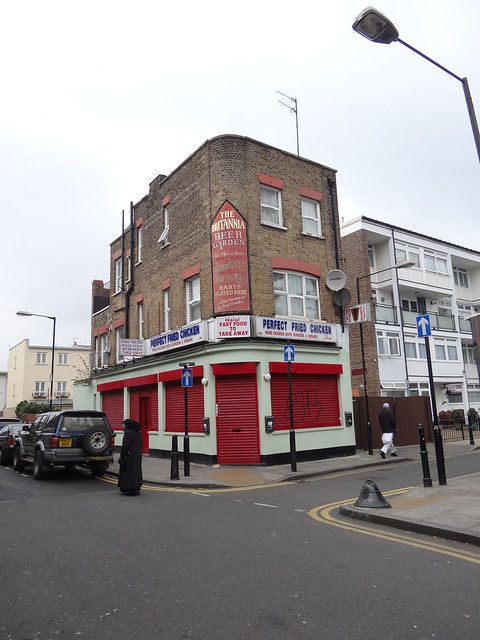
About the photo: The former Britannia Pub in Shadwell, now a fried chicken takeaway. There’s something incredibly London about a former pub being reused to serve Halal fast food. While I think it’s a shame so many pubs in London are closing, I really like how they’ve kept the original signage outside.
Date Taken: Taken on March 9, 2013
Walk 10: Northern Line walk 1 – Morden to Edgware via Charing Cross
About the photo: Clapham North deep level shelter to let. Subsequent to this photo being taken, the space was let to Growing Underground, which grows food hydroponically underground and has ties to former Masterchef – The Professionals star Michel Roux Jr.
Date Taken: March 16, 2013
Walk 11: Northern line walk 2 – High Barnet to Kennington via Mill Hill East and Bank
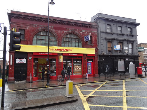
About the photo: Former South Kentish Town Station and old Castle pub. This is one of those perfect combo shots, a ghost station and a ghost pub. The former Castle pub building on the right, was subsequently partially demolished by property company Ringley, without proper planning permission.
Date Taken: April 28, 2013
Walk 12: District line walk 1 – Earls Court to Upminster
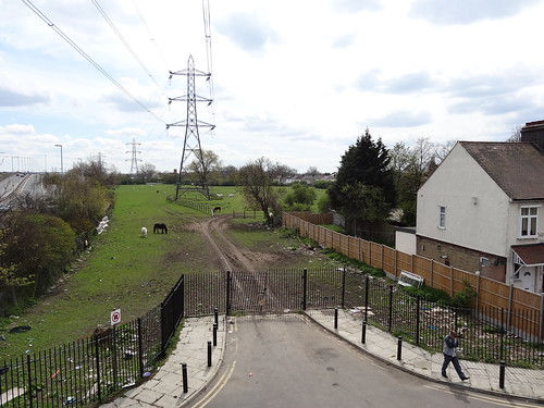
About the photo: A field full of horses next to the North Circular between East Ham and Barking. There’s something rather strange about seeing a field full of horses in such an urban environment that (as far as I see) is not part of one of London’s city farms.
Date Taken: May 5, 2013
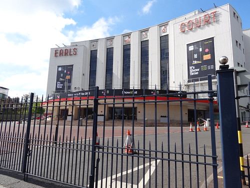
Walk 13: District line walk 2 – Edgware Road station to Earls Court and then to all other branches
About the photo: Earls Court Exhibition Centre. Earls Court was the hub of my District line walk and a great example of Art Deco architecture. So I find it rather sad that it’s now permanently closed and looks as though it will be demolished.
Date Taken: May 19, 2013
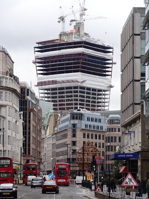
Walk 14: Walk 14: Metropolitan line walk 1 – Aldgate to Wembley Park
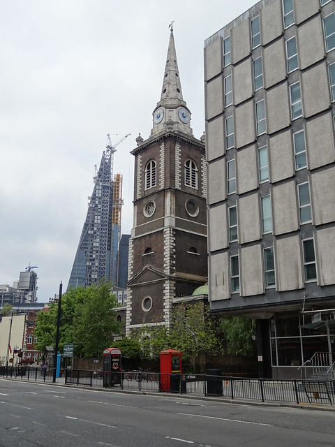
About the photo: Old and new building in the City. The reason I took this photo was to show the Cheesegrater still under construction. However, looking back at it, there’s a fair bit of history on display.
The church is the wonderfully named St. Botolph without Aldgate and was completed in 1744. The building to it’s right is the former Matrix building, an example of the brutalist architecture popular in the 1960s and 70s. It’s currently being redeveloped into Matrix House Aldgate, a 275 room, 4 star hotel.
Finally, in the far left of the photo, you can see the top of the Lloyd’s building, Richard Rogers Grade I listed masterpiece completed in 1986.
Date Taken: May 25, 2013
Walk 15: Metropolitan line walk 2 – Wembley Park to Uxbridge and Harrow-on-the-Hill to Moor Park
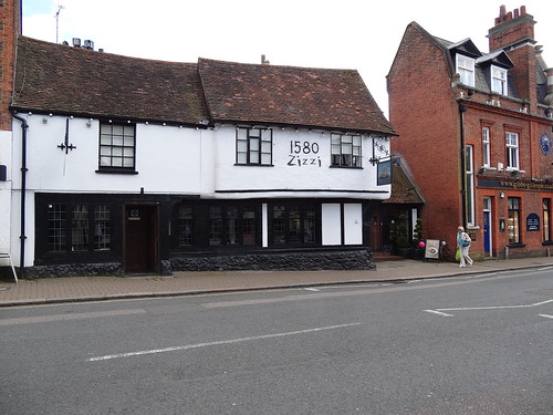
About the photo: Zizzi in Pinner. It’s located in the old Victory pub, which dates back to 1580 (as you can clearly see in the picture). While I have nothing against Zizzi (I actually quite like their food), this photo sums up the ongoing homogenisation of the British high street and the loss of architecturally interesting British pubs.
Date Taken: June 2, 2013
Walk 16: Metropolitan walk 3 – Watford to Moor Park to Amersham to Chesham
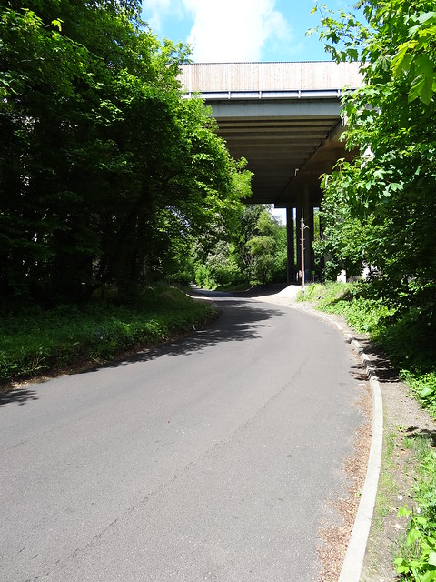
About the photo: Road under the M25. London itself changes the further out you go, dense Victorian terraced houses give way to less dense interwar homes which in turn giveway to countryside. This photo shows how the final transition looks. A simple country road, with no pavement (sidewalk for Americans) under one of the busiest motorways in the country.
Date Taken: June 22, 2013
Walk 17: Piccadilly line walk 1 – Hatton Cross around Heathrow to Acton Town
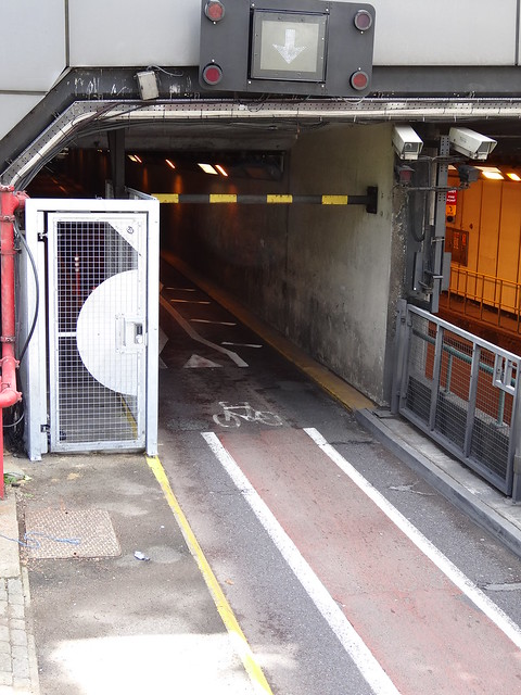
About the photo: Not a cycle lane into Heathrow. Despite Boris Johnson’s love of cycling and the expansion of the Cycle Superhighway there is no legal way to cycle to Heathrow Terminals 1, 2 & 3 station (also the only station you can’t walk to). However, this was not always the case as you can see at some point in the not too distant past, a dedicated cycle lane did exist. It’s now used exclusively by taxis.
Date Taken: July 21, 2013
Walk 18: Piccadilly line walk 2 – Uxbridge to South Kensington
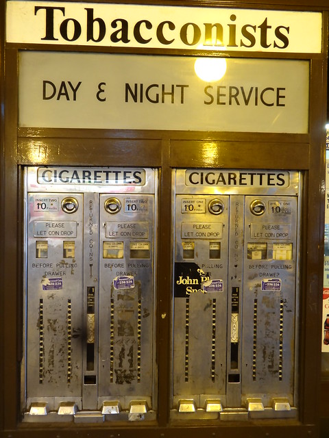
About the photo: Automatic tobacconists at Uxbridge station offering day & night service. I love that TFL have kept these two (non-working) machines at Uxbridge. Not sure how old they are, but given that they’re selling cigarettes for 20p, they must pre-date the London Underground smoking ban by at least a few years.
It’s odd to think that until 1984 you could still find smoking carriages on the tube. And that full non-smoking enforcement only began after the terrible King’s Cross Fire in 1987.
Date Taken: July 27, 2013
Walk 19: Piccadilly line walk 3 – South Kensington to Cockfosters
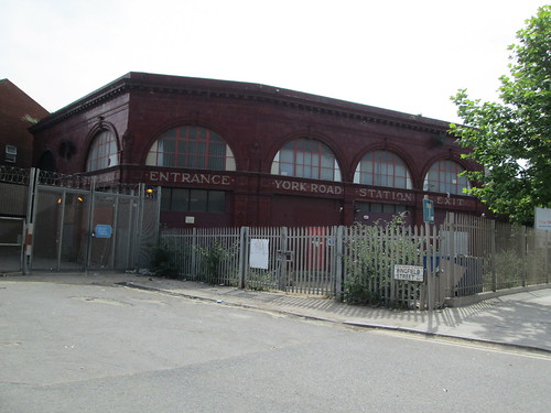
About the photo: Former York Road Station. York Road is one of London’s less famous ghost stations and was located on that long stretch of the Piccadilly line between King’s Cross-St. Pancras and Caledonian Road.
While it closed in 1932, you can clearly see the surface building today. However, given the recent development in the King’s Cross area, it probably stands the greatest chance of any ghost station of being reopened at some point in the future.
Date Taken: August 4, 2013
Walk 20: Central line walk 1 – Ealing Broaway to West Ruislip
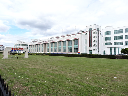
About the photo: Old Hoover factory, Greenford. The Hoover Building has to be one of London’s best examples of Art Deco architecture. In a move symbolic of the ongoing changes in the British economy, Tesco bought the factory buildings from Hoover in 1989 and subsequently turned them into a Tesco Superstore.
Date Taken: August 11, 2013
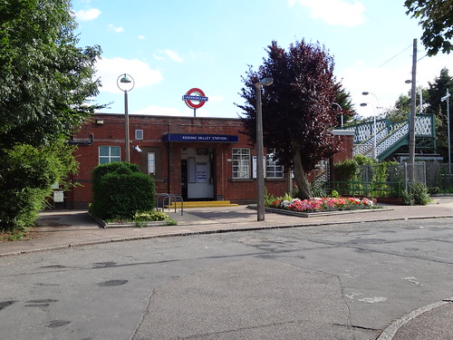
Walk 21: Central line walk 2 – Epping to Woodford via Hainult
About the photo: Roding Valley Station. This is London’s sleepiest Underground station with only 255,000 entries/exits in all of 2014. To put that into context Oxford Circus recorded 269,863 entries/exits per day (98.5 million per year) in 2014.
Date Taken: August 18, 2013
Walk 22: Central line walk 3 – Leytonstone to Bank
About the photo: Olympic Stadium and Park. Taken a year after London 2012, you can still see the original lights on the Olympic Stadium and see that most of the Olympic Park is still under conversion to what will become the Queen Elizabeth Olympic Park. Interestingly, despite its name, the Queen Elizabeth Olympic Park is not one of the Royal Parks. Nevertheless, it’s well worth a visit if you haven’t already been.
Date Taken: August 24, 2013
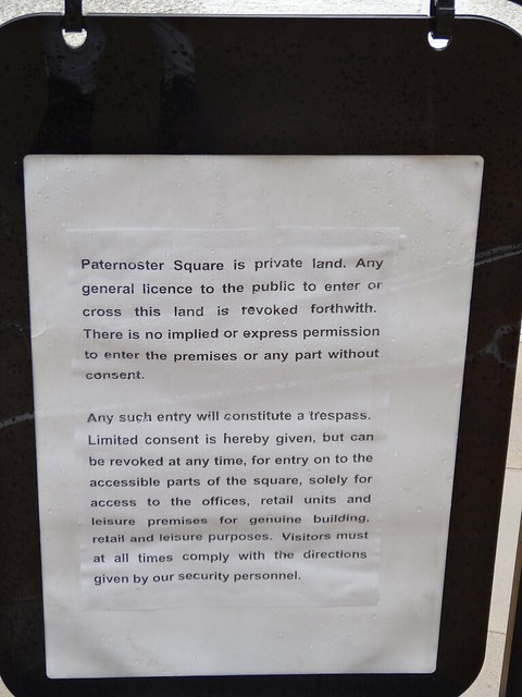
Walk 23: Central line walk 4 – North Acton to Bank
About the photo: Paternoster Square (location of the London Stock Exchange and located next to St. Paul’s) sign. This photo was taken over a year after the Occupy London protests, ended in 2012. As a walker this is one of the most worrying and sad changes I’ve seen developing in London in recent years.
Basically it just says that the security personnel at Paternoster Square can ban you for whatever reason they wish. This is diametrically opposed to the British concept of rights of way and a perfect example of the privatisation of public space.
Wikipedia has a great List of privately owned public spaces in London, many of which surprised me. The Guardian also has more even more data on the subject.
Date Taken: March 8, 2014
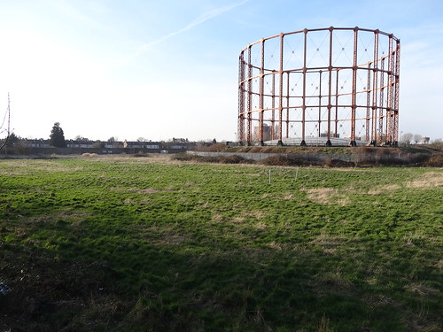
Walk 24: Gospel Oak to Barking Overground
About the photo: Gas Holder, East Ham. I love reminders of London’s not too distant industrial past. However, what I really like is the lone football goal post in the field in front, suggesting at one point people could play here. Now there seems no way to access the field. Incidentally, this gas holder is located just the other side of the street from the horses seen in the photo from walk 12.
Date Taken: June 21, 2014
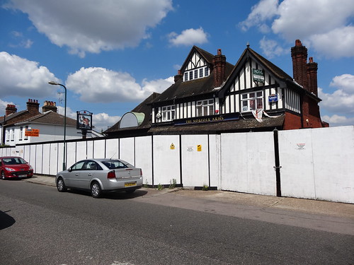
Walk 25: Euston to Watford Junction Overground
About the photo: Former Norfolk Arms pub, North Wembley. This is just one small example of how many pubs outside of central London are struggling and closing. I came across a large number of pubs facing closure and even more that had clearly been converted in the past.
While there’s nothing obviously special about the Norfolk Arms, the one thing that caught my attention, as a Canadian, was the sign for Labatt’s Canadian Lager (not one of Canada’s best beers incidentally). I found it odd since I thought you rarely found Canadian beer in the UK, until I learned that Carling is actually Canadian (I’m so sorry).
Date Taken: August 2, 2014
Walk 26: New Cross Gate to West Croydon via Crystal Palace Overground
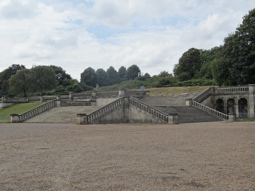
About the photo: Former Crystal Palace stairs, Crystal Palace Park. The Crystal Palace is one of those great London stories and is the very embodiment of change. Originally, built in Hyde Park to house the 1851 Great Great Exhibition, it was subsequently moved down to Sydenham Hill in 1854. Finally, it was destroyed by fire in 1936, but it managed to lend its name to the Park and surrounding area.
All that remains today are a few random statues and these stairs. Again, if you haven’t been you really should since both the station and Park are among my favourites.
Date Taken: August 24, 2014
Walk 27: Stratford to Richmond Overground
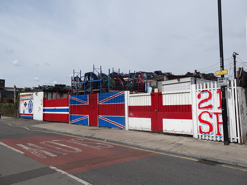
About the photo: Car Doors, Hackney Wick. To be honest I’m not sure if these doors are part of a scrap yard or the next art installation. In either case, Hackney Wick is set to see massive redevelopment over the next 10 years and I expect both scrap yards and art installations will not survive the process.
Date Taken: August 30, 2014
Walk 28: Lewisham to Bank DLR
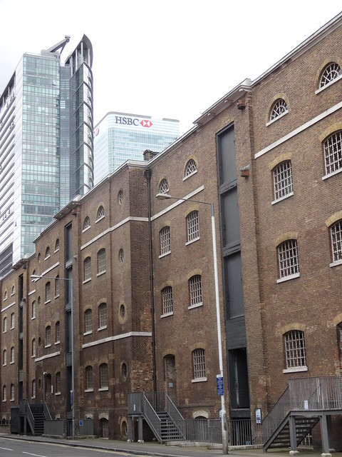
About the photo: Warehouses and Banks, Canary Wharf. This a classic contrast of old a new you can find in many parts of London. In the foreground you have old sugar warehouses that house the Museum of London Docklands, among other things. In the background you have the skyscrapers of Canary Wharf. Neither would have been built if it wasn’t for the profits that trading provides.
Date Taken: September 14, 2014
Walk 29: Overground Circle (Kentish Town West to Kentish Town West)
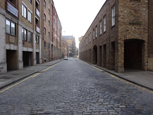
About the photo: Wapping High Street. Of all of London’s High Streets, Wapping’s feels the most anachronistic and far removed from modern London. It’s also often eerily empty, which I am sure it would not have been the case when the docks were in full operation.
Date Taken: January 10, 2015
Walk 30: Tower Gateway to Beckton DLR
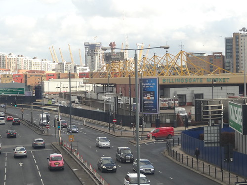
About the photo: Billingsgate Fish Market. Billingsgate operated in the City of London starting from 1699 and at one point was the world’s largest fish market. The market moved from the City to its current nondescript location, next to the A1261 in Canary Wharf, in 1982. Looking at it now, you’d never guess at its long history.
Date Taken: February 1, 2015
Walk 31: Stratford International to Woolwich Arsenal DLR
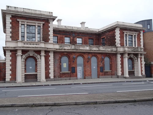
About the photo: Former North Woolwich station. This might just be London’s grandest and saddest ghost station. It’s located in the relatively empty approach to the Woolwich ferry.
The station building opened in 1854 but closed in 1979. Rail service continued at the station, using a more minimalist entrance, until 2006 due to the opening of King George V DLR station nearby. The station building reopened as the North Woolwich Old Station Museum in 1984 but it too closed in 2008.
Thus, I think making it London’s only ghost station and ghost museum.
Date Taken: March 8, 2015
Walk 32: Beckton to Stratford International DLR
About the photo: Canning Town. While Canning Town is one of my least favourite parts of London, I took this photo because I think this area will be unrecognisable in 10 years time, given the current pace of building, and I wanted to capture before it changes.
Date Taken: March 15, 2015
Walk 33: Stratford to Lewisham DLR
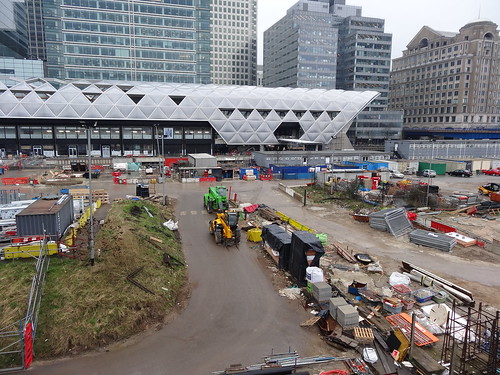
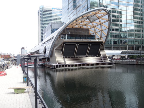
About the photo: Future Canary Wharf Crossrail station. Another attempt at taking a photo before the whole area changes. In 4 years time, the foreground will be unrecognisable.
Date Taken: March 28, 2015
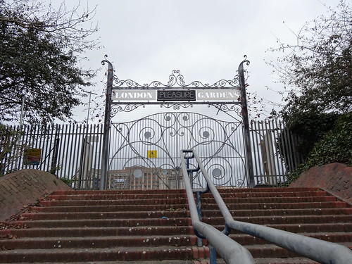
Walk 34: Cable Car
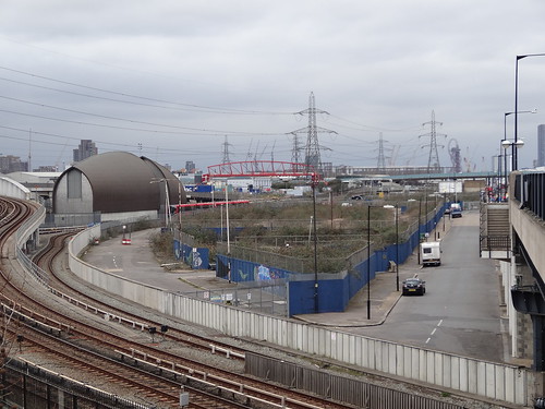
About the photo: Failed London Pleasure Gardens, Pontoon Docks. A London 2012 project that failed almost right from the beginning. A prime site for redevelopment, it likely won’t stay this way forever, but curious that remnants from it’s sad, brief history are still visible 3 years later.
Date Taken: June 6, 2015
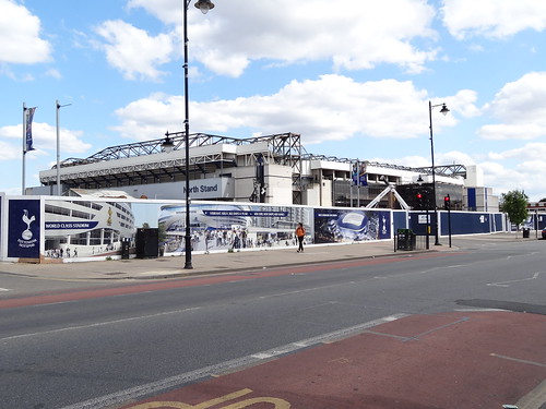
Walk 35: Cheshunt to Enfield to Liverpool Street Overground
About the photo: White Hart Lane, Tottenham. I took this photo for two reasons. First, White Hart Lane is the only English football stadium I’ve visited. Second, its redevelopment story is another interesting one, pitting Tottenham Hotspur FC vs a Archway Sheet Metal Works, a family-run business.
Date Taken: June 21, 2015
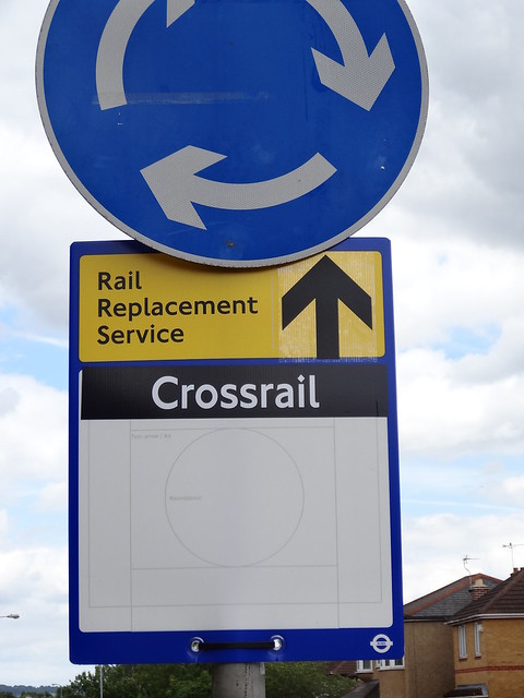
Walk 36: TFL Rail Liverpool Street to Shenfield
About the photo: Good to see TFL already have plans for how to handle Crossrail weekend engineering works in 3 years time.
Date Taken: July 19, 2015
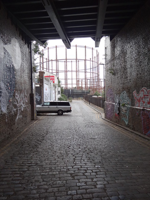
Walk 37: Liverpool Street to Chingford Overground
About the photo: Gas Holder, Cambridge Heath. Another fun anachronistic photo. The car makes it look like this could almost be the 1980s east end and not what you’d expect to find in 2015.
Date Taken: August 9, 2015
Walk 38: Romford to Upminster Overground
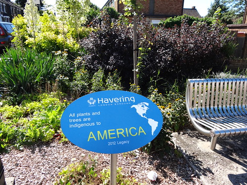
About the photo: Americas garden in Havering. Surely, one of London’s smallest but oddly appropriate London 2012 legacy projects. I thought this was appropriate since there were so many signs of the Olympics when I started my walks, but was not expecting to see much 3 years later in the depths of zone 6.
Date Taken: August 9, 2015
Walk 39: Woolwich to Bank DLR
About the photo: Canary Wharf Crossrail station. A second photo of the station for the simple fact that Crossrail is going to be the next major addition to the Tube map when it opens in 2018/19, which for me potentially means a whole lot more walking….
I hope you enjoyed the photos and that they perhaps inspire you to explore London just a little bit more (or move here if you don’t live here already). Also, if you’d like to show your support for the project, my Just Giving page is still accepting donations.
For more on walking the Tube, Mark Mason has literally written the book about the tube portion of the walks (the longest and most interesting sections).
Finally, if you have any questions or comments about the walk please leave them below and I’ll do my best to respond.
Note: All images can be used in any way you wish so long as you provide attribution back to RandomlyLondon.com
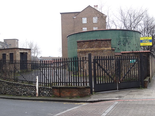

Regarding walk 24 that was the old N Thames Gas Board ground every major and a lot of smaller companys and utilities had these facilities until corporate greed swept most away.They had football pitches,a cricket square,tennis courts and a bowling green,they also had an area for the kids to play along with a nice club house,theres no profit in the employees social and physical welfare.I was fortunate to play on these grounds mostly around south and east London.They? say our kids are obese,but when they have underfunded council pitches which are lumpy at best plus dodging the dog shit and discarded needles with unhygienic changing facilities if they are open in the first place wheres the incentive to play sports.Still we are all in it together according to call me dave interpreted as fuck the little people.
Very interesting, thanks for taking the time to comment about the spot. Passed it on several walks and always wondered about its history. Seems very sad that it’s not longer used since it’s quite a large space in a part of London lacking many large parks.
hi Ian, I have just gone through your 39 photos again and can give you a bit of history/background on a few of them if you wish,also looked at the Gospel Oak to Barking walk as I now live Havering
,but was born and bred in Camberwell.
Regards
Brian
That would be great. Any info you can provide would be most interesting.
Hi I can give you some background on some of your other photos if you wish.
Regards
Hi Ian,As promised here are a few ramblings to go with some of your excellent photos.
Walk 2 ,Victorian underground toilets-we had one in the middle of Camberwell Green,where I grew up the attendant kept a couple of goldfish in the gents cistern above the urinals,another one I used was between Chancery Lane and Holborn Circus when I worked at the Daily Mirror,but they were an every day sight and something you took for granted,beautiful architecture and workmanship.I believe there are a few that are now coffee/wine bars.Its a shame that the tourists who visit London can’t get to spend a penny in these old toilets,some of the attendants were worth the visit, proper characters,but the IRA put paid to that back in the 70’s unfortunately .
I’ve come across quite a few of the remains of these over the last few years. And you’re quite right, several have them have been turned into coffee shops (like the one pictured) or bars/clubs. I figured that most of these closed due to council budget cuts rather than the IRA.
Walk 4 The infamous Heygate.This estate was at the northern end of a triangle that went all the way to New Cross and then back through the estates of Peckham and Camberwell. An idea emanated that as the old houses were demolished and replaced by tower blocks they should be joined by walkways so it would be possible to walk within the triangle without coming down to ground level. Unsurprisingly it never got off the ground,excuse the pun,somebody in the brain department of the town hall realised it was a muggers paradise.They tried it in the peoples republic of Lambeth on the Stockwell Park Estate,but soon demolished said walkways due to you guessed it-muggers and general anti social behaviour.There was also talk of refurbing some of the Heygate blocks to house our MP’s due to their pillaging of the public purse regarding funding second homes in London during the weeks that Parliament is sitting,needless to say that was buried without ever coming to life.I saw in the Evening Standard flats for sale on the Heygate site for over a million quid,quite insane if you know the area or perhaps I’ve been gone too long.
I walk through the Barbican on my way to work and it seems to be the exception that proves the rule about walkways. Good documentary about them in the City: https://vimeo.com/80787092 . While I can certainly believe they’re trying to sell flats down in the former Heygate estate for a million quid, no way they’re worth that. Still many nice parts of London where that kind of money will get you a very nice house.
Walk 10 I read an interesting article in one of the papers regarding growing underground, if there are any spare bits of the northern line infrastructure in that area of Clapham it would be ideal as it is one of our deep level tubes it goes underground just outside Morden station and doesn’t come up until it nears its end in north London.
It is or was the longest continuous tunnel on the tube at around 15 miles or so,it may be superceded by crossrail. I would need to check.
Yes, I wonder if the Crossrail underground section will be longer. Suspect it will be.
Thanks Brian for all your comments.
Hi Ian. Very nice site, thanks for sharing your experience.
I know it’s been a while since you’ve completed your challenge but I have a question for you: If you were starting over again from scratch and really wanted to walk as much of London as possible, what kind of system would you use? I’m thinking about trying to walk all of Seattle, which is my hometown, and debating what kind of tracking system to use. Top of the list right now is a database of the 200+ pieces of public art throughout the city but I’d love to hear if you have a different though. (Our transportation system is nowhere near as good as London’s and would be a very poor substitute I think.)
Hi Vic,
Really glad you enjoyed reading this post and am especially happy to see the reach extending into the US. I think if I wanted to see as much of London as possible today, I would likely just extend my transportation theme so either all rail lines or if I was feeling really ambitious all bus routes (but at over 500 it would take more than a decade even doing one new one every weekend.)
That said I think in a city with poor public transit (which let’s face it is most cities in North America) something like public art make a lot of sense. Or if you’ve lived in many different parts of Seattle try walks between them all (I’ve done this for 3 out of the 4 places I’ve lived here). Another idea is trying to link together all the public parks in Seattle, although I’m not sure how many there are.
Best of luck with your adventure. I really miss walking the whole Tube, but don’t really have the time theses days to start a similar adventure.
Ian
That said I think lining together 20
What a truly lovely set of photographs and many thanks for posting.
I have been traversing London with a camera for the past year and much is very interesting, particularly the link between old and new which, of course, is everywhere. That you’ve captured very well indeed so as to time frame development…. love to talk sometime.
Trevor