This post is part of my Randomly London v. The Tube Challenge. Get the latest about challenge updates here. Donate to Bowel Cancer UK here.

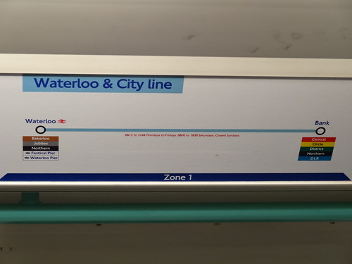
The Waterloo & City line is the amuse bouche of my 11 course tube challenge. The line itself is both the youngest* and shortest on the network. At only 1.5 miles (2.5 km) long and consisting of just two stations (Waterloo and Bank), I was able to walk the whole thing in about a half hour. A nice easy start.
However, everything did not quite go according to plan. The original idea was to both ride and walk the line on the same day. I set off on a beautiful sunny Sunday (Aug. 19th, 2012) walking to Waterloo from South Ken. Normally the Waterloo & City Line is closed on Sundays. However, Transport for London (TFL) moved to a 7 day a week schedule for the line during Olympics.
I naively assumed that this applied to the whole period from the opening ceremonies of the Olympics to the closing ceremonies of the Paralympics. Even TFL’s website seemed to indicate the line was going to be open. So I was somewhat surprised to find the whole thing shut down. Really not a big deal, but it meant I had to make a separate trip a few days later to ride the train.
I’ve been to Waterloo station many times, but had never bothered to do a complete wander around the outside. While at first glance there’s not much to see, a quick wander around the outside is well worth doing. I didn’t do this on the walk itself, but when I came back to to take the Tube one stop.
Around Waterloo
The first thing I notice when leaving the station’s main entrance are the tracks heading to Charring Cross. Many small businesses have set-up shop under the railway arches – a feature of London I find rather unique. I’ve even had the opportunity to work in an office under a railway line in Kentish Town.
I continue clockwise around the station along the very aptly named Cab Road (where you can of course catch a taxi). Around the southern side of the station Cab Road turns into Station Approach Road. However, I have the feeling that I’m not supposed to walking here – despite several other people doing just that. The area provides a rather uninspiring view for the low-rise flats dwellers who live immediately across the street.
Just before Station Approach Road turns to go under the tracks, I spot the Old Vic Tunnels. A bizarre yet interesting space I’ve been to only once before, but which is open regularly for art installations. Continuing around under the tracks is the low point for the walk. I keep feeling like I might end up getting hit by traffic.
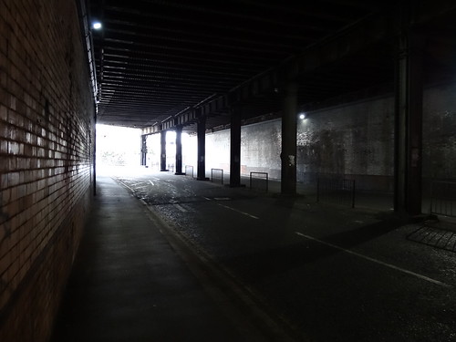
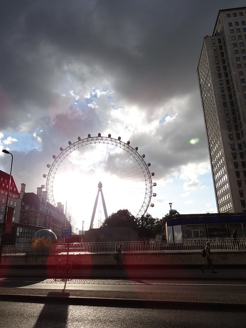
Once I emerge from the tunnel the Park Plaza Hotel is to me left. It looks nice, but is very difficult to get to on foot, as it’s in the middle of a large roundabout. Not exactly pedestrian friendly. Finally, as I continue along the northern edge of the station I get a great glimpse of the London Eye in the late afternoon sun.
From Waterloo To Bank
This is as good a place as any to start my tube challenge. Waterloo Tube station is the busiest on the entire network with 82 million people a year coming through. Despite the fact that the Waterloo & City line itself is not open on the day I choose to do my walk, I’m happy to get the whole project started.
It’s a sunny day with barely a cloud in the sky, that is to say not London weather. I begin by walking counter-clockwise around the BFI Imax, which again is in the middle of a roundabout and also contains Britain’s largest cinema screen.
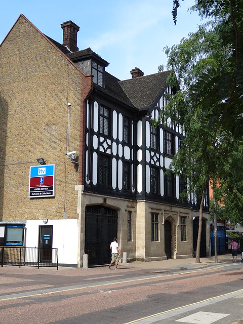
I then head down to Upper Ground Street, a bit of a hidden gem in my opinion. While less than 100m from the embankment, the street is almost always deserted (at least on weekends). Walking along it I pass The London Studios, ITV’s main studio in London. Next is Gabriel’s Wharf, which has a collection of open air restaurants and bars all of whom seem to be doing a good trade given the weather.
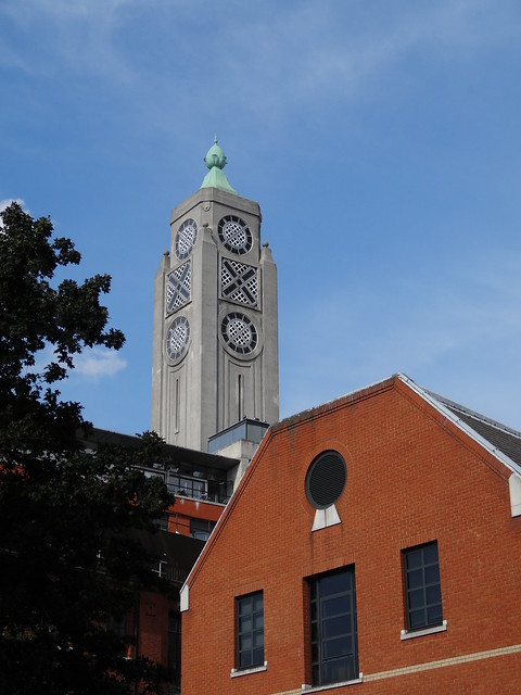
Just slightly further along I’m able to catch a few glimpses of the top of the art deco OXO Tower. The design is result of a failed application to put advertising directly on to the building. Instead the windows were built in such a way that coincidentally spelled OXO.
At the end of Upper Ground Street I come to Balckfriars Bridge Road. At this point immediately to my right is an open construction site for the Beetham Tower, yet another Southbank tower development. To my left is Doggetts pub, which is housed in a hideously ugly building. It’s one saving grace is that being a Nicholson’s pub, it has a decent Ale selection on tap. From here it’s left on to Blackfriars Bridge itself, which technically brings me into the City.
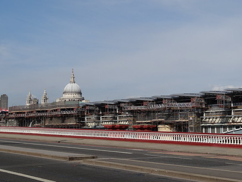
Now Blackfriars Bridge is not too exciting, what is exciting is Blackfriars Railway Bridge, which is to the right as you head North. There are three things that make Blackfriars Railway Bridge unique among London’s bridges.
First, it is the only bridge to have railway platforms over the Thames, these were built as part of the Thameslink upgrade plan. Second you can access the platforms from either side of the Thames (Blackfriars is the only station where this is possible). Third, the Bridge is being topped with Solar PV panels, which will generate around half of Blackfriars station’s electricity needs when completed.
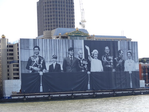
At the end of Blackfriars Bridge is Unilever House, which is crowned in flags from around the world in support of the Olympics and Paralympics. Behind me Sea Containers House still has the enormous portrait of the Royal Family from the Queen’s Silver Jubilee in 1977 on display. Given that it was installed for the Queen’s Diamond Jubilee a few months ago, I’m wondering how much longer it will stay up. Must be a bit of a pain for the people who work in the offices.
From here I head along Queen Victoria Street with The Blackfriar pub on the left and the cavernous entrance to Blackfriars station on the right. Queen Victoria Street is one of those utilitarian thoroughfares you find in different parts of London. Not very pretty to walk along, but probably necessary for vehicles wanting to get in and out of the City. It also has the added benefit of leading straight to Bank station.
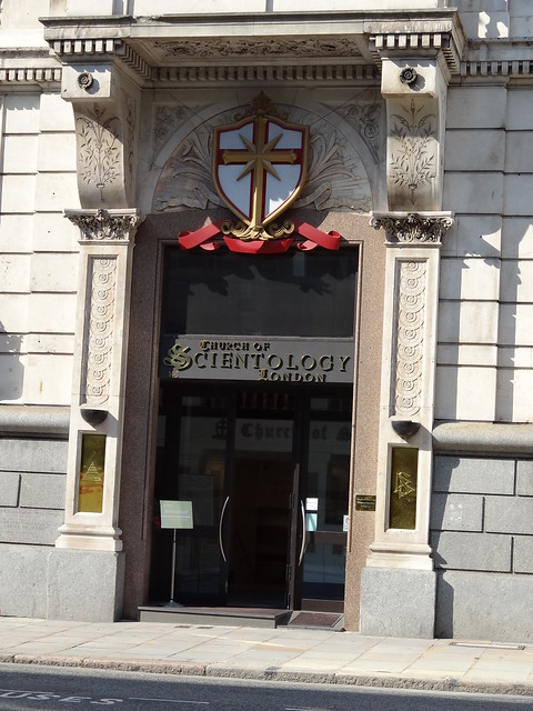
I’ve walked along this street several times in the past, but this is the first time I’ve noticed the London headquarters of the Church of Scientology at number 146. However, no sign of Tom Cruise of John Travolta. A short distance ahead I come to Peter’s Hill. Looking to my left I get one of my favourite views of St. Paul’s and arguably it’s best approach. Looking to the right I get a glimpse of the Tate Modern across the Thames; along with the hoards of people attempting to cross the Millennium Bridge.
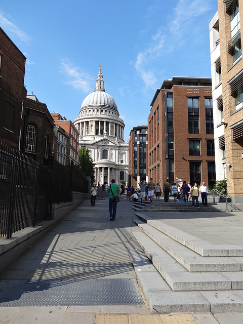
Also to my right is the City of London School, an independent boys school which faces out over the Thames. While the school building itself is not that impressive, it’s location certainly is. I have a hard time wrapping my head around the fact that there are children who go to school on the Thames right in the heart of the City of London. The students at the counterpart City of London School for Girls have to make do with their school being located in the far less scenic Barbican Estate.
I continue along Queen Victoria Street and right around Old Fish Street Hill I see the Gherkin come into view. Then it’s up and around past Mansion House Tube Station, which ironically is not the closest station to the Mansion House (that honour belongs to my final destination, Bank). A heritage routemaster cuts in front of me along Cannon street. I always see them when I’m not in position to take one.
From here it’s only a few hundred metres to Bank. Along the whole right hand side is a building site for what will become known as Walbrook Square. It’s located on the site of the former Bucklersbury House. However, since there is no building above street level at the current time, you get a unique view of the rather uninspiring Walbrook building. Still, I likely won’t be able to get this view in a few years time.
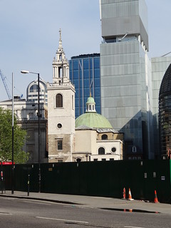
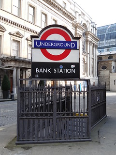
This brings me to Bank. I can see the Stock Exchange immediately in front of me, the Mansion House to my right and the Bank of England just up ahead to my left. On neither journey do I spend any time walking around the area immediately surrounding the station. I know from past visits that there are many things to see, such as those mentioned above.
On my walk the area is eerily quiet, but I know that on the following day it will be a hive of activity. The Bank-Monument complex is the 8th busiest tube station on the network (yet, it’s practically empty on the weekends) and the second busiest non-National Rail station (Oxford Circus is busier).
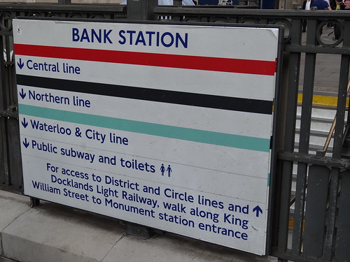
At just 1.7 miles walking distance, this walk is an order of magnitude smaller than my next one along the Victoria line. Still, it’s set the whole ball in motion. Please stay tuned for future updates. You can see all the photos from my Waterloo & City Line walk and Waterloo station visit on Flickr.
*Technically the Waterloo & City Line only joined the underground network in 1994, before that time it was operated by National Rail.
10 Waterloo & City Line Facts:
- Walking Distance: 1.6 miles (2.6 km)
- Track Length: 1.5 miles (2.5 km)
- Walking Time: 30 minutes (approximate)
- Opened: 1898
- Stations Visited: 2
- Favourite Station: Bank
- Least Favourite Station: Waterloo
- Line Nickname: The Drain
- Notable Random Sights: Blackfriars Solar PV Bridge and Church of Scientology
- Random Fact: Bank station used to be called ‘City’ station hence the name of the line.
Waterloo & City Line Walk Route Map:
View Larger Map
- Donate money to Bowel Cancer UK
- Subscribe to my RSS feed, follow me on Twitter, ‘like’ my Facebook page, or +1 my Google+ Page
- Write about the challenge on your own blog/website and/or link to this page. To contact me please send an e-mail wrightlondon [at] gmail.com
- Share this page on social media sites such as Twitter/Facebook/Google+, etc. (see buttons at the bottom of this page)
- Follow my current progress here.
- Buy me a pint or a night out (walking is thirsty business) – Just use the Paypal Buy Now Button below